Tuesday, July 24, 2007

Alaska Highway: Entering the Yukon

Road from Liard to Teslin

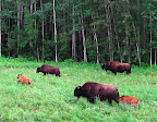
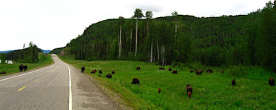
Soon after we left Liard Hot Springs, we saw a large herd of bison grazing along the highway - mostly cows and calves. We had seen "watch for bison" signs, and they weren't kidding! Luckily, the highway is straight and has wide shoulders for better wildlife visibility, and there is not much traffic, so it is easy to avoid collisions. It would be very intimidating to ride through a herd of Bison on a motorcycle, though, not to mention a bicycle!
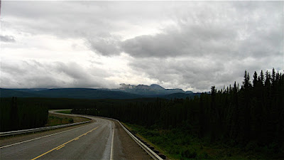
Today it rained most of the way, but as the sun came out, the scenery got better, and it's quite beautiful here. This stretch of the Alaska Highway plays keep-away between the British Columbia and Yukon border, crossing back and forth several times before finally deciding to move into the Yukon.


Along the way, we began to see mystery tracks along the side of the road. At least Devin thought they were tracks - I was pretty sure they had been made by something mechanical for the highway, since they were so regular, there was a set on each side of the road, and they went on and on for miles. I just about had him agreeing with me, when we caught up with the makers of the mystery tracks - two HUGE Bison bulls, one on each side of the road, walking north. The mystery deepens! The cows and calves were miles back - why were these two solo bulls walking north on the highway, on opposite sides of the road yet together, away from the herd? Were they outcasts? They were both so huge and healthy looking, it is hard to imaging they had lost a dominance challenge - maybe the females just didn't want them around...?
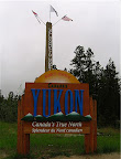
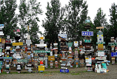
Finally we got to the official border crossing and stopped to take our obligatory photo of the sign - "Welcome to North of 60" and "Yukon, Canada's True North." Shortly after the border we came to Watson Lake and many more signs- tens of thousands more - the famous Watson Lake Signpost Forest! According to the website Explore North,
One of the most famous of the landmarks along the Alaska Highway was started by a homesick GI in 1942... and you can even add your own sign to the over [60,000] already there!

In 1942, a simple signpost pointing out the distances to various points along the tote road being built was damaged by a bulldozer. Private Carl K. Lindley, serving with the 341st Engineers, was ordered to repair the sign, and decided to personalize the job by adding a sign pointing to his home town, Danville, Illinois. Several other people added directions to their home towns, and the idea has been snowballing ever since.

What a crazy place. We didn't stop or add our own sign, but did drive around the block and took photos of the tens of thousands of signs taking up a couple of acres of land.


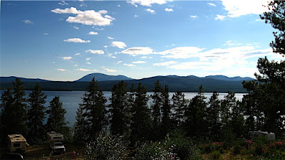
Further up the highway, we checked out Dawson Peaks RV Park as a potential place to camp - it was very nice, in a forest on a lake, and we read in The Milepost that it was featured in the Sue Henry Alaska Mystery,"Dead North" which sounded interesting, but something told us to keep going that day.

We ended up at the famous Mukluk Annie's, where everything is FREE, FREE, FREE!
  • Free camping on Teslin Lake
  • Free dump and fill
  • Free boat ride with dinner
  • Free RV wash with dinner
  • Salmon Bake (not free, but a great deal by itself!)
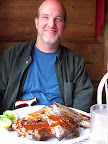
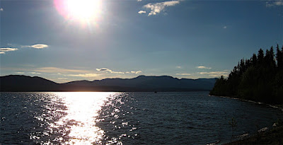
What a deal! The free campsites are really nice, overlooking Teslin Lake - we needed water and to dump our tanks, so that was great, too. We were hungry and went to dinner - omg. HUGE portions! Quite good, too - salad bar with green salad and fixin's, potato salad, pasta salad, rolls, baked beans and baked potato, then a huge plate of salmon and/or ribs, grilled right there, coffee and/or tea to drink, and even dessert!

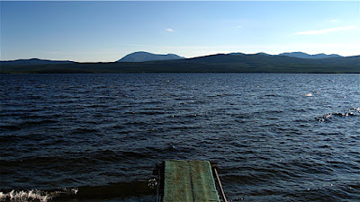
The only problem was I fell asleep after such a huge meal and missed the free boat ride. It was supposed to leave at 8pm, and I got there probably a minute or two after and the boat was already pretty far out, so I think they left early. So sad, standing at the dock alone... I guess I'll try to collect on the way back, if they are still open.

Teslin and Teslin Lake seem to be big Tlingit areas - with museums and stores offering Tlingit goods. We crossed the continental divide again today - up here the water on the west drains to the Bering Sea/Pacific via the Klondike River, and the waters to the east drain into the MacKenzie and into the Arctic Ocean up by Inuvik. The native people on this (west) side of the divide had Pacific salmon runs and a plentiful, regular food supply, so tended to be more settled in villages, where the ones in the Arctic watershed generally did not have a reliable food supply in one place, so followed the Caribou herds and were more nomadic. A very clear example of how environment affects culture.

I talked to some bicyclists in front of the restaurant who were riding the Alaska Highway south, and I was thinking how intimidating it would be to have to ride between those Bison bulls on a bike! The woman was from Quebec and had monster thighs - she's obviously been doing this a while. She is riding to South America! The man was from Germany, and they were just riding together for a while for safety - they had just seen a bear crossing the road earlier today.

Today, in addition to the bison, we also saw Harriers, Golden Eagles, deer, and two black bears - one dead and one alive. The lake here has swallows - barn swallows and rough-winged(?) and terns and gulls. I'm sure there are ospreys and bald eagles, too. We passed through lots of moose country, but didn't see any today. We also passed through a Caribou Herd area, but didn't see them, either. Still, a herd of bison, two huge lone bison bulls, a golden eagle, 3 harriers, a deer and 2 bears is pretty darn good for one day's drive!
Sunday, July 22, 2007

Liard Hot Springs

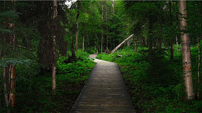
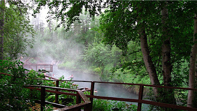
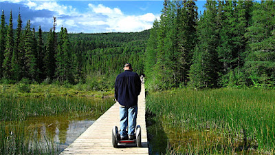
Liard (rhymes with "weird") River Hot Springs Provincial Park was quite wonderful. The public campgrounds in Canada are all so nice and well-maintained. This one was quite full and we were lucky to find a campsite, but we found a nice private site with trees all around. This area is very lush with vegetation. After driving all day, Devin is usually pretty tired, but I wanted to take a look around, so I took a radio and walked over to check out the hot springs. They were much farther in than I expected - maybe almost a mile into the forest on a boardwalk path. It first crosses a large fen, then enters the forest. I felt a bit like Dorothy on the yellow brick road - expecting to encounter the tin woodsman around any corner!


When I finally got to the lower pool, I was surprised to find several people there since I hadn't seen anyone on the way in. I foolishly did not wear or bring my swimsuit, since this was supposed to be just a short scouting mission! So I continued a bit further, checking out the "Hanging Gardens" before it started to rain in earnest.

The "Hanging Gardens" were dry, but the gardens along the boardwalk all the way to the end were lovely - I noticed 2 kinds of orchids (the white Ladies Tresses, and the green Rein Orchid), white Anemones, yellow bush Potentilla, wild Rose, Baneberry, False Solomon's Seal, wild Raspberry, Horsetail, Rushes, yellow Monkeyflowers, Fireweed, and some blue flowers - I thought they were a kind of flax, but I think they were something else, and more I can't remember.

I decided to head back as it was starting to rain harder, but in the shade of the large trees I was staying dry... along with several dozen mosquitoes who had the same idea, apparently! After a while, getting wet didn't seem like such a bad idea, as it wasn't all that cold, so I started down. I stopped at the lower pool and sheltered in the dressing room, but started feeling sort of creepy being in there with no good reason. I sure wished I had a swim-suit, since the pool looked so inviting and steamy in the rain. It was definitely not a "swimsuit optional" vibe, though, so I walked back in the rain.

When I got back I was able to take a hot shower in the RV and crawl into bed all warm and toasty.

The next morning we discovered that the towel over the Jeep window may not have been a great idea. Since I had attached it by hanging the ends inside the removable "Freedom Hard Top" (front of the roof), and since it had rained on it, it was all wet and had wicked water into the Jeep - it was humid and a bit mildewy smelling in there - ewwww. So we left the windows down and put the towel on the roof to dry and decided we'd just risk rocks hitting the windshield.

We decided to stay another night here so Devin and I could go back up to the hot springs and soak. Devin took his Segway, which was great on the boardwalk. We walked all the way to the upper springs, but the Alpha (lower) pool is much nicer than the Beta (upper) pool. Though beautiful, the upper pool is 3 meters deep (over 9 feet) and mucky on the bottom. It's like very warm bathwater - you can swim in it. But there are no benches, just stairs going in, so it just wasn't as inviting for us. Both are natural, minimally developed (not cement pools, just added decks and benches). The lower pool had a nice gravel bottom, a waterfall between pools that you can sit under while it massages your shoulders and back with warm water, underwater benches out in the middle and at the edges, a deck with stairs into the pool at various points, changing rooms, benches, and composting toilets set away from the water. What a beautiful setting!

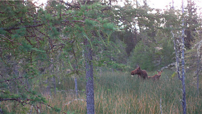
After a nice long soak, we had a pleasant walk back as it started to rain lightly again. We saw a moose cow and calf in the fen area on the way back! A perfect ending to another wonderful day.

Alaska Highway, Fort Nelson to Liard Hot Springs

Today's drive was spectacular! Quite a contrast from day 1 on the Alaska Highway (yesterday), we passed through some of the most spectacular scenery and wildlife sightings of the whole road today.

Stone Mountain Provincial Park took us up into the Rockies again, over Summit Pass, the highest point on the Alaskan Highway, and wildlife was abundant. We saw many Caribou with calves and Stone Sheep, a kind of bighorn sheep. Technically, the stone sheep are "small horn" sheep, but I couldn't have told you the difference by horn size. They were a darker color than our Mojave and Sierra Bighorn back in California, though. And not at all shy!


The weather was beautiful - stormy with little spates of rain toward the end of the day. Nice cloudscapes. The road took us along beautiful rivers and through gorgeous mountains - this is definitely an area that would be worth a trip to explore all on its own.

There is camping in Stone Mountain and also along the beautifully surreal turquoise waters of Muncho Lake, where we saw even more Stone Sheep clinging to the cliffs along the road, Caribou and calves, and even Bison! The Highway around Muncho Lake is quite a feat of engineering - we read that they lowered men on ropes to place explosives underwater to make the road cut in the cliff. It's one of those places where you almost feel guilty for driving at the same time you are glad the road is there so you can see it.

Devin said, "it's nice to be away from the hustle and bustle of places like... Montana" ha. But that's the way you feel as you get farther and farther north - fewer and fewer cars are on the road, more wildlife, and more a feeling of the freedom of the open road. Adventure is always just around the corner!

We drove to Liard Hot Springs, where we camped for two nights. Liard rhymes with "weird," by the way. We got into camp early enough that I went on a little scouting walk to the hot springs - fantastic! More about that next post.

See more photos of today's adventure

See more photos of Stone Sheep

Saturday, July 21, 2007

Alaska Highway, Dawson Creek to Fort Nelson

Dawson Creek is "Mile 0" of the Alaskan Highway! We had to drive by the little Mile 0 marker "downtown" Dawson Creek and get the obligatory drive by shot. Since it is in the middle of the road, it was a little hard to get from the passenger side, so Devin did a little driving and shooting in the RV. I bet Dawson Creek sees a lot of this!

A little history - the "AlCan" was built as a WWII military road. It was built by the US Military, through Canada, to connect the lower 48 states with Alaska. It was truly an amazing feat, building this road through the densely forested, mountainous terrain, criss-crossed with many large rivers, in a very short time, even by today's standards. It's worth reading about the history of the Alaska Highway in the Milepost and at the various historical markers along the way. They started at both ends and met in the middle!

Speaking of the Milepost, a bit of advice: don't do what we did and wait until you get to Mile 0 to buy it! Canadian prices are much higher - think of paperback prices, where they show US and Canadian prices.... You'll save about $10 if you buy it in the US. Plus, the Milepost contains valuable information about roads getting to Mile 0 in Dawson Creek, and you can read ahead some, and do some planning ahead, if you have it sooner.

As long as I'm giving advice, we learned another valuable lesson in Dawson Creek: just because our wireless broadband card worked there, didn't mean we were in our home territory. We had signed up for the Verizon "America's Choice plus Canada" cell phone plan, and assumed it covered our wireless broadband card (for accessing the internet) also. Not true. Later we got a bill for about $600 - we were being charged by the minute because we were roaming. Be sure to find out all the details of your plans in advance of leaving the country! From Dawson Creek north, we didn't get much internet or cell service, anyway, in spite of what the service area maps had shown. "No, I can't hear you now..."

Our first day on the Alaskan Highway was uneventful. As we left Dawson Creek, we passed more agricultural fields - hay and the brilliant yellow fields of canola (I think) - very pastoral. It was a bit windy, too, so it was good there wasn't much traffic and the road is quite straight, for the most part. Devin talked about our position in the tourist open... ha. He says we're winning, usually. It's good he has such a rich inner life.

Great visibility today! Fair weather cumulus clouds marching off to infinity.

After a short way we began to get into Spruce and Aspen forests with wildflowers along the road. Beautiful, but no spectacular scenery. Just miles and miles of spruce forest - mostly black spruce - fading up and down in elevation to white spruce, aspen, and pine. This peaceful monotony was broken occasionally by evidence of oil and gas exploration - 'poison gas' signs on side roads sort of discouraged stopping and picnicking.

Landmarks along the way were the Peace River, crossed by a long, uphill bridge, and Bigfoot! The Peace River Valley is a lovely area with farms and fields along the river.

Bigfoot, well, Bigfoot Crossing is apparently a truck stop. We didn't stop, but got a picture...

We arrived in Fort Nelson and stayed at an RV park on the north side of town, with a "saloon" where we ate a tasty dinner.

We camped next to a gentleman from Iowa with a large motorhome - he had a blanket across the windshield of his tow vehicle and I asked about it. He got to talking about the roads, and he said they were "worse than you could ever imagine"! I sort of doubt that... we have pretty good imaginations, and plus, we've practically taken the RV 4-wheeling... out in the Mojave Desert in Johnson Valley, when we had to go around an RV stuck in the sand - we "jumped" a sand wash and all the dishes fell out of the cabinets... but that's another story. he he.

Nonetheless, I decided maybe it would be a good idea to cover the Jeep windshield, so I took off the "Freedom Hardtop" (the front part of the roof) and put a big beach towel across the windshield, held in place by the (reattached) roof, doors, and windshield wipers. Now any stray gravel might get its impact dampened a bit, at least.

Monday, July 16, 2007

Jasper to Dawson Creek

As we left Wabasso campground, on our way up to Jasper, we saw a bear right on the side of the road - I even got a photo. Our first photo of a bear!

While we are enjoying these beautiful parks and the Canadian Rockies, we are anxious to continue on with our journey. You see, Canada is nice - nice and expensive!!! Gas is over $4/gallon here! And groceries are expensive, and it costs $17.80 a DAY to just BE in the national parks, and camping is an extra $20 on top of that, for unimproved campgrounds! So we're talking about $38/day just to camp in the national parks in the Rockies. Didn't make us feel like lingering too long, though it was beautiful.

We went up to Dawson Creek from Jasper via the "Scenic Route to Alaska" - a bit of a short cut. We missed seeing the neat couple we met in Baja who live in Edmonton by doing so, but it is getting late and we want to get to Alaska before it closes! Just kidding. I really regret not taking the extra side trip, time and miles to visit Alethea and Bernardo - they were just a wonderful couple, but we needed to get to a place with WiFi by Monday so Devin could do some work, and we wanted to be on the Alaska Highway asap. Dawson Creek is "Mile 0" of the Alaska Highway.

The "scenic route" paled by comparison to the incredible Icefields Parkway and scenery of Banff and Jasper, but it was pleasant. We drove through forested rolling hills, crossed a big river, and drove by a very large coal mining operation of some sort - not a mine, but where the coal was either shipped from or processed or something. We passed one small town at the crest of a hill before descending into another river valley, and ultimately getting out onto flatter country.

Getting up to Dawson Creek we left the Rockies and were on the prairie - the towns could be anywhere with malls and housing tracts, except for the Real Canadian Markets and the Tim Horton's. Some beautiful fields of bright yellow flowers - I think it may be Canola oil (Rapeseed) plants. Also, more hay.

Dawson Creek is a nice town - it has a mix of newer shopping areas, and some historic districts around the "Mile 0" marker, and agricultural surroundings. The Northern Lights RV Park where we stayed had some nice views of the sunset over town and was across from more fields.

Nothing too exciting happened in Dawson Creek - Devin worked three days remotely; we got the RV oil and leveler fluid changed. Devin went to clinic for more antibiotics. Friday, my eyelid started swelling again (the same one that sent me to the emergency room in Jackson Hole), so I started on the eyedrops (which I had leftover), and washed the lid with baby shampoo, and it went back down.

The clinic experience is worth recounting: we called to see if we could get an appointment and they said to come on in - they were really nice, of course. We saw the doctor and got a prescription, which we were able to pick up in their pharmacy, no problem. The interesting part was paying - Canada, as you may know, has national health care. So when I asked how to pay, they asked if the price they quoted sounded fair and reasonable. I wonder if they would have lowered it had I said no? But $55 for an office visit and $40 for prescription (10 days 3xday penicillin) seemed quite reasonable. They weren't used to dealing with cash - no credit card method, checks were "a problem" and so they let me go get some cash from the credit union around the corner, and the nurse made change from her purse!

The Northern Lights RV Park has some nice services for travelers - one of their sons does work on RVs - he changed our oil and hydraulic leveler fluid, as I mentioned before, and they also repair windshield chips and make special rock guards for tow vehicles. The rest of the trip we would see these guards and know that those people had stayed at Northern Lights! More on the need for rock guards later.

We had a thunderstorm!! The rain was nice, and it cooled things off for us, finally.

Beautiful sunsets at the Northern Lights RV Park.


Sunday, July 15, 2007

Radium, BC to Jasper, Alberta - Kootenay/Banff/Jasper Parks

We drove from Radium, BC to Wabasso Campground near Jasper, Alberta today, and took so many photos! It was just a beautiful day, with spectacular scenery, as we traveled the Icefields Parkway from Banff to Jasper. Our day's drive took us through three national parks - Kootenay, Banff and Jasper! Along the way we saw a bear, glaciers, lakes, rivers in amazing colors, waterfalls, and incredible mountains.

The Wabasso campground was pleasant, and our campsite was near the Athabasca River. We took a bypass to get here - which was a fairly narrow and bumpy road after the smooth highway, but nice to be on a quieter side road in the beautiful Jasper National Park.

Here is a slide show of some of the highlights:


Saturday, July 14, 2007

Crossing into Canada

Oh Canada! I want to be Canadian. I'm mad at Devin for not becoming a Canadian citizen when he had a chance - when he was married to Maple! (If he had become a Canadian citizen then, I could now, and we could move to Vancouver!) Canadians just seem... generally less insane than Americans. Canada is so neat and, well, nice. And beautiful - the Canadian Rockies are Gorrrrrgeous!

We kept seeing these signs along the road, and so we followed them. The signs advertised smoked salmon and more for miles, and finally led us to a fish truck! We bought some smoked salmon - yum! They were frozen, and I kept them cold and ate them like popsicles - Devin thought the idea of Salmon-sicles was gross, so, hey, more for me! He he.


We drove up through funny name entry - uh, Port Rooseville, up to Radium Hot Springs. There were these odd boulders up on legs at the crossing - art? Nice easy crossing with no waiting - and yet again, we didn't even get checked.

At Radium, we were looking for a campsite, and realized that if we went west there, through Kootenay National Park, there were only two choices and the likelihood of us finding a spot big enough on a Saturday evening in July, so close to Calgary and the Stampede days, were probably pretty slim. So we decided to go north, which would take us through Yoho National Park and into Lake Louise, from where we would continue on up the Icefields Parkway to Jasper. We stopped at the visitor center in town and the terribly nice staff loaded me up with free information and maps, and we headed north - only to find that traffic was backed up because of a bad accident, and it could take 2 hours to clear... another very nice Canadian drove over to our window to tell us this. Canada is just so nice!

So, since we were by a driveway, and up the road there would be no turning around for us, we turned around there. I noticed it said RV Park, so we figured it was serendipity and drove down. Secure gate with intercom to get in - it looked extremely nice, but when I asked how much, it would be $50 for the night!!! Not so nice. So we consulted maps, turned around and drove back south of town to a nice little Provincial Park, Dry Gulch, where we found lots of open campsites for $17 a night. That's more like it.

Driving through the campsite, we were witness to the final stages of what must have been a very heated argument, as a guy was throwing someone's stuff all over the campsite, a girl was on her cell phone crying across the street. Okay, maybe not all Canadians are perfect. Then the campsite staff came running - there were at least four of them, and when I was down at the pay station, the Mounties were there! The RCMP - a very nice young man, and I directed him to the trouble. They all spent quite some time sorting it out - quietly - and ended with the arguers leaving and apologizing profusely. Okay - when do drunken (I'm assuming here) arguments end with heartfelt apologies to authorities in the states? Not that often, I'd wager. Back to nice.

A Thunderstorm came through as they were sorting things out - with the same rhythm of build-up, crash and flash, then gentle rain and sunshine through the clouds in the end. Very nice - especially since it cooled down the very hot afternoon considerably! Devin and I sat out in lawn chairs during the rain! I wanted more, but it was great to get any after such heat.

I made another version of "Bamix Bean Dip" for dinner (with black beans, pepper jack cheese, non-fat plain yogurt, lime juice, some salsa, cumin, lemon pepper, cayenne, and paprika), and that's all we ate (with chips). A nice cool meal. I wish we could run the air conditioner on the inverter - I mean, we can, but it would drain our batteries pretty quickly, I'd guess. It's hotter here than it was in Baja!! Of course, we were there in March and April, and it's July now.

With new tires in front, and properly aligned front wheels, our ride today was SO much smoother!! Now we are ready for the Alaskan Highway - and we'll probably get there by next week. We hope to be in Jasper tomorrow night, and then we need to find an RV Park with good WiFi so Devin can do some remote consulting/contract work for a few days. After than, we are on the Alaskan Highway! We may have to stay in Dawson Creek for the WiFi, as there aren't any listed in Jasper, and as long as we are heading up, we may as well go to Mile One of the Alaskan Highway.

Friday, July 13, 2007

Glacier National Park

Enjoy our "Going to the Sun" Slideshow:


After getting our alignment done this morning, we spent the rest of the day enjoying the scenery! We drove through Glacier on the "Going to the Sun Highway" - beautiful! It is a narrow, winding, mountain drive that hangs on the edges of cliffs, goes under and over waterfalls, up above timberline at Logan Pass, and is generally gorgeous. Highlights were seeing Mountain Goats - even if they were right in the road, surrounded by tourists, licking water off the road (instead of drinking from pure mountain streams nearby - I guess they liked the saltiness? The "Weeping Wall" where we drove under misting waterfalls with the top off the Jeep and I got a little shower, views of Bird Woman Falls and numerous others, beautiful mountains, and , yes, even some glaciers. We also enjoyed the area behind the visitor center at Logan Summit - meadows full of Glacier Lilies, snowfields, and scanning for wildlife.

I mentioned previously how Devin stayed in a cabin in Glacier years ago, and read "Night of the Grizzlies," which happened right in the area where he stayed. I read it, too, so I could share in that memory with him, and we drove by Lake MacDonald on our way out and looked at the cabins in "Kelly's Camp" area where he stayed. Though we kept our eyes out, we didn't see any grizzlies today, though.

The weather was VERY warm - it was 100 degrees in Kalispell, and not all that much cooler in Glacier - no wonder the glaciers are melting at such a rapid rate! Glacier is still a beautiful National Park, though it will be sad to see its namesake glaciers all retreat into tiny snowfields as world temperatures rise. In places like this, as well as above the Arctic Circle, Global Warming is a very real and very serious threat. Here it is to scenery and the local ecosystem, but other places it is to people's very way of life and even ability to live there. No one in Alaska is arguing about global warming - they see it up close and personal. But more on that later...

After our long day's drive (and yes, we are contributing to carbon emissions that contribute to global warming by doing so, as is everyone who drives - we have bought carbon offsets through TerraPass, however, and we hope that helps), we returned to Kalispell by way of Whitefish and the UPS store, where we picked up packages in the nick of time - we walked in just as they were about to close! Now we are ready to head north.

Back to Kalispell to get ready to head to Canada tomorrow!!

Kalispell - Legacy Timber Town

Saw a sign in a store window that said "We Support the Timber Industry" and it reminded me of Humboldt County, where I went to college. It made me sad, because it reminded me of the divisiveness and polarization of that community around forest management issues. Politicians like to reduce complex issues into simplistic sound bites and talking points, like "jobs vs. owls" which is SO untrue - but gets people elected as folks fear for their livelihoods. Logging is an old and time-honored profession, and I hope there is still logging hundreds of years from now - because of course, that'll mean there's still forests big enough to log. Sustainability isn't just for forest ecosystems, wildlife, fisheries, watershed, and recreation, but also for the economy and jobs. If loggers want to retire and have the next generation also able to retire doing what they love doing, we can't cut down the last remaining forests!

Kalispell is a "legacy" timber town, because although the timber industry still seems important here, there is a large amount of growth and new construction, shopping malls, and suburbs sprawling out from the town's center, which is also beginning to see renewed growth.

It's a beautiful area, obviously undergoing some difficult changes in economy, but I see lots of hope there for it to become a really wonderful place to live and enjoy.