Showing posts with label Arizona. Show all posts

Saturday, May 19, 2007

North Rim, day 4: Grand Canyon Lodge, Bright Angel Point, and Point Sublime

Grand Canyon Lodge: We started this day by going back into the Park, filling up the Jeep with the cheap gas (they still had last year's gas at last year's prices!), and checking with the visitor center to make sure the road to Point Sublime was open - it is a four-wheel-drive road out to another viewpoint we wanted to visit. Then we went over to the Grand Canyon Lodge to see about dinner reservations and check out the old rustic style building and views. The Lodge is designed so it will be the visitor's first view of the canyon. When you drive to the North Rim, you don't see canyon views like you do at the south rim - they are hidden by trees and the road is in the center of the promontory, not on the rim. The Lodge is at the end of the road, and when you enter it, you are greeted with huge picture windows affording you your first good view of the Grand Canyon. Quite the entrance!! It's a neat old lodge, with many similarities to the Ahwahnee Hotel in Yosemite - dark timbers, stonework, craftsman style lighting, and native-inspired designs. But its grandeur takes a back seat always to the Canyon itself, naturally, and also by architectural design. The huge two-story windows in the sun room and dining room make sure of that! There are two patio areas on either side of the sunroom, and trails below leading to viewpoints, including Bright Angel Point.

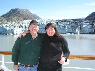
Bright Angel Point: Devin waited on the patio while I hiked down to the points below the Lodge and out to Bright Angel Point - lots of neat bonsai'd trees growing in the rocks along the trail caught my admiration. There were lots of people on the trail, yet at the same time, so many less than on the South Rim. There was a certain camaraderie among us - a willingness to chat and laugh with strangers and share admiring comments. I met a French couple and we talked about coffee and travels for a bit, and a couple of guys were sitting on top of boulders out at Bright Angel Point - laughing about how they were having a macho moment after having "conquered" the paved trail out there. On the way back, I caught this couple in a classic "tourist" pose!


Sometimes the people are the best part;
I call this: "Blondie and Dagwood go to the Grand Canyon"

More Lodge and Bright Angel Point Photos

When I got back, it was lunchtime, and we decided to cancel our dinner reservation (the earliest they had was for 8:45, anyway, after dark) and have lunch instead. Typical park food - okay but not great, spotty service, but great views!!! We then had to find ice for the roast turkey sandwiches I'd made us for lunch (since we weren't going to eat them now), and we were off to our Point Sublime adventure.

Point Sublime: The point isn't advertised on signs - the road that leads to it is only marked with "Widforss Trailhead" which leaves from a parking lot about 1/2 mile in. After that, it just says "primitive road" and we didn't expect it to be a real four-wheel drive road. After all, in Joshua Tree, they call the Geology Tour Road a 4wd road, and it really isn't - it's just a dirt road with some bumpy spots. But the Point Sublime Road soon proved itself to be the genuine article, as we maneuvered over large rocks and deep ruts and "whoops" in the road, up and down steep hills, through very fine silt across meadows, and through some lovely scenery in the 18 mile, two hour drive out to the point. About 1/2 way in was a side road to a camp spot and view of the Canyon up a side canyon, and another side road that lead out to Fire Point and Swamp Point - those points have access roads from the National Forest and we could potentially take that road "home" to our campsite in the Forest! But it was going to be too late when we returned, so we'll have to save that exploration for another time.

When you are approaching Point Sublime, it's very obvious as you begin driving out onto a peninsula of rock separated from its neighbors by deepening chasms. At one point, the road passes over a narrow neck with canyon views on both sides before you get to the top of the ridge and drive right out to the point! We didn't see a single car on the way out there - Saturday in late May in a National Park - imagine! But there were two other cars out at the point -- a Hummer and an FJ Cruiser. So we completed the set of major 4WD vehicles with our Jeep Wrangler! The Hummer belonged to a couple from Switzerland who were out on the very point taking photos. The FJ belonged to some apparently anti-social people who really had wanted the place all to themselves, I'm guessing.

The views from the point were incredible, and yes, it lived up to its name. As the sun went lower, the light just kept getting better and better, and it was hard not to keep taking photos of the same things as each time you looked they seemed more beautiful than before. Again, words won't describe it like photos can!

On the way back, we came across a flock of wild turkeys in one of the many large meadows! At first we thought they were deer, as from a distance we could see large animals moving through the grass, but they moved funny, and were darker... as we got closer we saw what they were and took photos and a couple of movies, but since it was quite low light, most came out fairly blurry (especially since the turkeys kept moving rather quickly, too). A nice wildlife sighting to end another adventurous day!

Friday, May 18, 2007

North Rim - day 3: East Rim, Point Imperial, Cape Royal and Angel's Window

East Rim: Starting fresh the next day, we drove the Jeep out of the forest, across the paved road, and back into the forest on the other side to check out the East Rim Viewpoint - that is where the people in the Park Visitor Center had suggested we go. There were LOTS of campsites along this, much shorter, road, and as we got out, even some with views of the canyon! But we weren't going to waste another day moving to a new campsite, and most of these were taken or on roads that the RV wouldn't have made it down. One was definitely a 4wd access road, and had a great campsite at the end with a trail out to a rock overlook of the East Rim - nice!

Point Imperial: Next we drove into the Park and out to Point Imperial - I almost crashed the Jeep when suddenly we had this amazing view open up on the side of the road!! Devin kept saying, "Don't Look!" Ha. At Point Imperial, we realized why this part is a National Park, and the other parts are National Forest. These views are much more spectacular and breath-taking. MUCH more! Most of the Forest views were of side canyons or much farther from the main gorge, and the Park views were like IMAX compared to a home video. Wow!

At Point Imperial, I met a couple and started talking to them about the helicopter we saw in the canyon (no doubt "flightseeing" from the south rim). Turns out the man, Glen, was hiking in the Grand Canyon years ago, doing a long North to South Rim in one day hike, when he came across a man with a helicopter, almost at the bottom. There was a little bit of movie set left, and only this one man, and they'd finished filming for the day, "Brighty of the Grand Canyon"! The man offered Glen a free helicopter ride out of the canyon! He said it was the hardest choice he'd ever made - his heart was set on hiking North to South Rim in a day, but he'd never been on a helicopter before! He chose to complete his hike. Another woman who was listening to the story said he'd made the right choice, because he couldn't do that hike today, but he could take a helicopter ride. He'd just had a hip replacement recently, but I think he may take a few more hikes after it heals. He said his only helicopter ride was in Alaska, going to the Beaufort Sea, flying over pingos (round, ice-heaved hills) - a very surreal landscape. Sounds like he's had an adventurous life, so I suspect there is more adventure to come. But maybe not rim-to-rim hikes.

Angel's Window and Cape Royale: We then drove out to Cape Royale, that has a wheelchair accessible path. I had checked with the visitor center and they said the Segway would be okay to use on this paved path as well. The visitor center loans out wheelchairs for people to take out there if they are not able to walk far, also. Of course, the Segway got a lot of attention, and we spoke to many folks who were very interested in one for themselves or a relative with a disability. We met a woman with Cerebral Palsy out at the main viewpoint who was very interested and Devin even gave her a demo. We seem to be ambassadors for Segway and Jeep wherever we go - ha.

On the way out to the main viewpoint, a wonderful surprise awaited us! There is a narrow promontory of Kaibab Limestone that juts out into the canyon, that has a very large triangular opening in it! It makes a natural bridge, and through the opening, you can see the rose-hued Canyon walls beyond, and in the right viewpoint, the Colorado River. This is Angel's Window, and I'd never heard of it nor seen pictures and it was awe- inspiring! Not only that, but there was a path out onto the top of it, over the bridge and to the very edge! Wow. We decided we had to have a photo of one of us standing out there on it from this viewpoint! But first we went on to the main viewpoint of Cape Royale.

Words can't describe the beauty of these Grand Canyon views, so pictures will have to suffice:
If this slideshow doesn't work for you, or you'd like to see it bigger, you can go to our Picasa Web Albums and view slideshows full screen, too - click here.

Thursday, May 17, 2007

North Rim - Days 1 and 2 (May 16-17, 2007)

Journey to the North Rim: The next day, we rolled in the awning, put away the chairs and battened down the hatches of our rolling home once again to head for the North Rim of the Grand Canyon. At the NPS dump station at Lee's Ferry, we saw a cool Horned Lizard that seemed to live there - watched it eat ants and do threatening push-ups toward us while we dumped our waste tanks and attempted to fill our fresh water tank.

They had a fresh water hose that works with the type of fill valves that open upwards, that you can just pour water into without pressure. Our fill valve opens to the side, and requires a hose with pressure and a threaded fitting. We had purchased a device called a "Water Thief" for just this sort of situation - it has a rubber sleeve to fit over non-threaded faucets on one side and a threaded hose fitting on the other. This was our first time trying it, and we discovered it can't take much pressure!! The NPS water valve was a lever that was either all the way on, or off, unless you held it manually somewhere in between. After a few attempts and Maggie getting thoroughly wet as the hoses burst apart and whipped wildly around, we learned that we need a hose clamp to make it work well at pressure! We finally figured that if one of us held the hose thief on with both hands (the type of clamps we had didn't work) and the other held the pressure just right, it wouldn't burst open and we could, slowly but surely, fill our tank. This was important as we expected to be dry camping for the next week! Before we were done, Devin looked like he was on the losing end of a water balloon fight - yay! Thank goodness it was hot there and that made it refreshing.

The drive past the Vermillion Cliffs and up the Kaibab Plateau was beautiful, and a study in life zones as we passed from desert scrub to pinyon-juniper woodlands to mixed conifer yellow pine and oak to fir and aspen forests and meadows at the top.

Arriving at the North Rim - hopeful expectations and sad realizations: Opening day was yesterday, May 15th - the road from Jacob Lake to the North Rim is closed until then, and the park doesn't open until the road opens officially. We knew the campground in the Park was full, because we had checked online where you have to reserve now, and there has been nothing for a while. A day here and day there, but no two days in a row anywhere. I wish they set aside a certain percentage of their sites for first come, first served, but now all the National Parks are on this ReserveAmerica or Recreation.gov sites, and you can reserve your campsites a year in advance - and it's specific by campsite, too!! So the few sites that are right on the rim with views are all booked up early, of course. Even so, we hoped there may be a cancellation we could capitalize upon. But we weren't counting on it, so we stopped in Jacob Lake at the Kaibab National Forest Visitor Center and got a forest map, found out about dispersed camping in the forest and some suggested sites with canyon views, and headed down the road.

We first went to into the Park and the Visitor Center to check about possible camping cancellations. We got our first peek through the trees of the Grand Canyon from the North Rim here, just walking along the parking lot to the Visitor Center. There we got more information about dispersed camping in the National Forest and some more suggested spots, then went to the campground to talk to the "Rangers in a box" at the entrance. They had just checked 10 minutes before for cancellations for the whole next week, and there were none. But they waxed eloquent about the great free camping on the National Forest with campsites right on the rim, so we headed back out to the forest.

With all this encouragement, and our dream of camping right on the rim of the Grand Canyon, we headed out to either Timp Point or Parissawampitts Point, where there were supposed to be fantastic panoramic views (according to our book of free campgrounds, too) and campsites all along the rim, and the road in was described as a "good gravel road." Okay, don't believe everything you read! It may have been a good gravel road for a car or truck, but for a 9 ton class A RV with 90 psi tires, it was a torture device designed to shake apart our home!! Washboard, even little washboard, is very hard in the RV, and there were some sections of BIG washboard on this road. Devin was driving 5 to 10 mph and having to slow down when we came to potholes and such. Over twenty miles of this was pretty stressful, to say the least. So we unhooked at the junction of Timp and North Timp points and drove down to decide which one.

Well, North Timp had a road that was do-able, but only a couple of appropriate campsites, with only very partial views on one or two, through lots of trees, and they were all taken already! Timp had a road that was NOT doable because of low tree branches and narrow spots, and one pretty nice campsite available, but we couldn't get there. This was very disappointing after being told by everyone that there were lots of places to camp and no one would be there and it was right on the rim. People exaggerate.

We drove back out to the washboarded "main" road we had come down, and went up toward Parissawampitts Point, but decided not to try it tonight, and found a campsite off a side road that wasn't being used, in a clearing that was probably an old "borrow pit" where they got the gravel for the "good gravel roads." It was nice to camp in the forest, with aspens all around, deer wandering through, and all, but it wasn't what we'd hoped for, and we were going to have to move the next day. We had wanted to find our camp site, and stay put for a while, relaxing there and also using it as a base for exploring further.


North Rim day 2 - finding a "real" campsite: The next day we kept the Jeep unhooked and I scouted ahead. We parked the RV again at the turn off to Parissawampitts, and it was about the same. Some nice campsites, but basically all taken, and no really clear views, and the road was much rougher than we wanted to drive down. So we decided to head back out to near the beginning of this forest road and camp closer to the paved road and park, and give up on the idea of a campsite with a view of the Grand Canyon. We found a nice campsite just 2.5 miles from pavement, in our own little clearing on a ridge surrounded by aspens and nice views of the sunset. We have our own herd of deer that seem to use the aspen thicket to bed down in at night, and there are lots of birds singing all the time. So it's a nice spot and a good location to use as a base camp to explore from.

Lesson learned: Next time we hear about great campsites down a dirt road, we'll unhook and check them out with the Jeep first! The Moho is not for driving down dirt or gravel roads - the Moho is our home, and we can park it nearby and explore and have adventures in the Jeep - that's what it's for! "Adventures" in the motorhome are not the kind we really like having... usually involving flat tires and things breaking. The idea of getting stuck way out on these forest roads was really was affecting both of our ability to enjoy being here. So we re-grouped, started over after two days of finding a campsite, and now we are ready to explore the North Rim.

This is really a beautiful forest, with huge meadows, aspens just leafing out, pines and firs, and we've seen lots of deer, Kaibab Squirrels (really cute black squirrels with tasseled ears and a white tail - we both thought it was a skunk when we first saw one!), Chickarees, bunnies, lots of birds, a coyote, and a flock of wild turkeys! We haven't seen any bears yet , or bison, which apparently have wandered up here now from the House Rock Wildlife Station down below the plateau. So now we can appreciate the Kaibab National Forest for what it is, and enjoy the North Rim of the Grand Canyon as well.

Tuesday, May 15, 2007

Colorado River Float Trip (5/15/07)

The float trip started at the Glen Canyon Dam - which is now a national security site, so we had to put all our backpacks on a separate truck when we got to the gate, and then our bus took us down through a two mile tunnel through the rocks to the base of the dam. Later, on the river, we could see the adits ("windows") into the tunnel sloping down from the top of the cliff where we started to just above the river. There is no lighting in the tunnel except the adits every so often, which also let in air, and were used to push out the excavated rocks from the tunnel.

When we got to the base, they gave us all hard hats to wear to the rafts, since we were walking under the bridge over the river, and people sometimes through pennies off - 700 feet directly over our heads. While MythBusters recently proved that unlikely to be fatal, I think it would probably hurt, so I didn't mind the hard hat!

There were dinosaur tracks in the rock at the bottom of the ramp, or at least very good replicas - they looked just like the tracks in the stone over at Tuba City. Sort of like giant ostrich tracks with 3 toes.

Our guide's name was Kelli, and she was more into history than natural history, which is okay with me since I know the natural history pretty well, having spent two weeks in a Geology of the Colorado Plateau honors field class, along with all my other geology, botany, ecology, desert ecology, etc classes and all the reading I've done, too! But Kelli focused on John Wesley Powell and his trip down this same river, showed us places where he climbed to the top, or waterpockets where he got fresh water (back then, before the dam, the Colorado was so muddy it was said to be "too thick to drink, too thin to plow"!). We also heard stories of his journey, saw formations he had named from his perspective, like Monk Rock. We stopped at some petroglyphs, went around the famous "Horseshoe Bend," saw nesting herons, ducklings, and white-faced Ibis along the river. Heard Canyon Wrens and Swifts, and in the deep shade of a canyon wall, saw a bat overhead so clearly you could see its "fingers" in its wing!

It was a nice day on the river, but one thing that was too bad is that they wouldn't let us hop on a bus from Lee's Ferry where we were camped and then take the raft back "home," saving us 2 hours of driving. The bus companies are all different contractors, I guess, and they said the one from that morning was full, anyway. So we had to drive into Page, float down the river to Lee's Ferry, get bused back to Page, and drive back to Lee's Ferry. We had dinner at Stromboli's in Page and got back after dark, pretty tired!!
For information on Glen Canyon Colorado River Float Trips, go to www.raftthecanyon.com

Monday, May 14, 2007

Navajo Country and Lee's Ferry (5/14/07)

Navajo Country

The road north (89) from Flagstaff goes through some beautiful "Indian Country" - interesting rock formations, mesas, badlands of the Painted Desert ("melting" shale hills of the Chinle formation), and small settlements with their hogans. The Navajo people in this area seemed like they may have been fairly well off or at least comfortable. Hogans were next to "regular" houses, and were framed, stuccoed, cement, paneled, or had siding. I think I saw one or two of the more traditional logs and adobe mortar, too, but most were "modern" hogans. Hogans are round or have six sides and the front doors always face east. Navajo culture is very infused with the appreciation of natural beauty, and many of their healing ceremonies are about restoring ones spirit to the path of beauty. The hogan is their traditional dwelling, but I think nowadays may be used more for ceremony and gatherings than day-to-day living. Or maybe it's the "mother-in-law unit" of the Navajo - ha. I kept thinking of how the US "gave" all this "useless" land to the Navajo - and how it is so beautiful and how that beauty is so important to them. The best natural resource of all, I'd say. It made me think of this Navajo Prayer, which I would quote to my groups when I used to lead loop trips through Yosemite's High Sierra. I would read it to them on Sunday morning, as we prepared for a 10 mile day heading down to Merced Lake from Sunrise, after a tough day getting up the "switchbacks from hell" to Sunrise the day before. The prayer has healing powers, I'm sure!


Navajo Prayer

House made of Dawn
House made of Evening Light
House made of Dark Cloud
House made of Male Rain
House made of Dark Mist
House made of Female Rain
House made of Pollen
House made of Grasshoppers

Dark cloud is at the door.
The trail out of it is dark cloud.
The zig-zag lightning stands high upon it.
An offering I make.

Restore my feet for me.
Restore my legs for me.
Restore my body for me.
Restore my mind for me.
Restore my voice for me.
This very day, take out your spell for me.

Happily, I recover.
Happily, my interior becomes cool.
Happily, I go forth.
My interior feeling cool, may I walk.
No longer sore, may I walk.
Impervious to pain, may I walk.
With lively feelings, may I walk.
As it used to be long ago, may I walk.

Happily may I walk.
Happily, with abundant dark clouds, may I walk.
Happily, with abundant showers, may I walk.
Happily, with abundant plants, may I walk.
Happily, on a trail of pollen, may I walk.
Happily may I walk.
Being as it used to be long ago, may I walk.

May it be beautiful before me.
May it be beautiful behind me.
May it be beautiful below me.
May it be beautiful above me.
May it be beautiful all around me.
In beauty it is finished.


Lee's Ferry

After crossing the Navajo Bridge over the Colorado River, we turned off to check out Lee's Ferry. Lee's Ferry is where the only crossing of the Colorado was for miles and miles for the early settlers, and now it is the put-in for river trips down the Grand Canyon, and the take-out for river trips down what is left of Glen Canyon below the dam in Page. It is a beautiful setting, with the Vermillion Cliffs as a backdrop to the north and west, and other, equally red cliffs to the south and east, with a campground overlooking the Colorado River right above Pariah Riffle. Pariah Riffle is the first rapid that Grand Canyon trips go through, and is formed where the Pariah River enters the Colorado. We had a great campsite with a view of the river and could hear the rapids as we slept. The first night we both laid out in our lounge chairs and stargazed in the warm desert evening. The next night, Devin ended up going out alone and sitting under the stars for an hour or so after midnight. He says it was magical. Warm desert evening with billions of stars and the sound of the river rushing by. We camped there two nights, enjoying the white noise of the rapids, the changing light on the red rocks, and the starry night skies. We went down to the put-in area and watched as the huge pontoon rafts were set up from semi trucks the day before their departure - it was quite the scene! They left the next morning and we could hear the "whoo!" as they went over their first rapid and got a small taste of things to come. We would love to do a Grand Canyon river trip some day!! Of course, you need reservations way in advance, and lots of planning and preparation for those, so we settled on a float trip from Page back to Lee's Ferry the next day.

That night we had a gourmet barbecue feast! We had purchased a "Santa Maria Style" marinated vacuum sealed tri-tip roast from Trader Joe's before leaving, and this was to be its night to be barbecued! So we got out our Weber Baby Q and the grilling supplies, and our new meat thermometer (Christmas Gift from Darby and Jean, making its debut performance) and set to work. Devin enjoyed playing with the Meat Thermometer - it is a remote digital style one, and once he figured it out, it worked great! I got to work making appropriate side dishes - it was hot, so I didn't want to cook inside, so I made some things to share the grill:

Veggie Grill Pockets

This idea came from our friend Anita - she did this out at Coon Hollow last December:

  • Take whatever veggies you'd like to grill and place them on foil squares - I put Carrots, Brussels Sprouts, and Onions on the bottom, since they can take longer to cook, and broccoli and mushrooms on top.
  • Sprinkle on whatever seasoning you like with your veggies - I used lemon pepper
  • Add some dabs of butter
  • Wrap tightly and place on the grill
  • Leave it on the grill till it's steaming hot - we just left it on as long as the meat, which was about 45 minutes on low heat to get all the way done - the broccoli was a bit overdone, but the rest was perfect!

Speedy Grilled Potatoes

I thought baked potatoes would be good with the tri-tip, but they take so long, so we did this, instead:

  • To speed it up, if needed, par boil potatoes
  • Slice into "Texas Fries" - slice large baking potato in half, then the halves into lengthwise strips. We made each strip about 1/8 of the large baking russet we had, but if you slice them thinner, they'll cook faster, but they may fall through the grill! Also, if you have a short potato, you can skip cutting it in half. Another way to speed up the cooking is to par boil them all cut up, which is what I did.
  • Take potatoes out of water when you can stick a cooking fork in a little easier, and let them drain or pat dry on paper towels (the whole par-boiling can be skipped and then you go directly to the next step)
  • Toss potatoes in a bit of olive oil and seasonings - I used Rosemary, Balsamic Vinegar, and some of Trader Joe's "21 Seasoning Salute."
  • Place directly on grill!
  • Turn over after they start to get grill marks on one side

The only problem with these is that it takes a while to turn them all over individually - if you have a larger grill, you could put them in a grilling basket and turn them all at once. Keeping the lid of the 'cue open longer made the meat take longer to cook - but that was okay, because it gave more time for the side dishes! These were DELICIOUS!!!

Sunday, May 13, 2007

Blackwater, Bakery, and Bonito (5/13/07)

Dump Station Event

When we left Dead Horse Ranch State Park, we went to their dump station to dump our wastewater tanks, as usual, and had an "event" - no, it was nothing like Robin Williams in "RV"! But sort of funny in a gross way... While we were there, another RV pulled up in the next lane (there were two sewage drains in the same concrete pad) and started getting their hoses set up to dump their tanks, too. Now, dumping isn't really all that bad, for those of you who've never done it out there. There is a procedure - and specialized equipment to make it easier and neater. We use a PVC elbow to connect the flexible hose to the drain hole in the ground. Another important piece of specialized equipment is "the rock." There is always a rock that people place judiciously on their hose-drain connection to make sure the waste goes down the drain! Some drain fittings have threads and we can screw one side of our elbow connector right in so there is no need for a rock, but many don't, so the rock is a bit of insurance to make sure the hose doesn't come out while dumping. Other specialized equipment we use is a small folding chair, hand sanitizer, and oh yeah, common sense!

The pieces of equipment our dump neighbors were lacking were the latter, the elbow connector, and the rock. The man put their hose directly into the hole, and the woman came over to "help" and put her foot on the hose, which popped it back out of the hole and pointed it at us! Neither noticed this before pulling the valve release handle on their RV and sending their blackwater streaming toward us, though I was saying "Oh no! Stop!" Luckily, it didn't come out with the force of a geyser like in the movie, and was mostly clear liquid, and Devin managed to avoid the stream, but it was funny to watch the woman, with her foot on the hose holding it out of the hole, saying "DO SOMETHING!!" to her husband!! Ha. They apologized multiple times and we said, hey, it all smells the same whether it's yours or someone else's, and we ALL sooner or later have "accidents" at dump stations! That's why we are always careful what we touch and use hand sanitizer immediately afterwards.

Some words about waste... when you carry around your own water supply (we have a 75 gallon tank) and your own waste, you become acutely aware of conservation. One thing we find is our grey water (from the sinks and shower) fills much faster than the black water (from the toilet). RV toilets are very water conserving, and ours has a little hose you can use if you need to clean the bowl rather than filling it all the way up with water. We have a system of wash and rinse water for dishes, where we keep both in tubs, and last time's wash water becomes the dirty pre-rinse water of the next set of dishes, and last time's clean rinse water becomes the soapy dishwater. So by the time the water is ready to dump, it's been used to rinse, wash and pre-rinse dishes. We then dump it down the toilet since that tank fills slower. This, along with our solar panel set up, extends our stay when "boondocking" or "dry camping," which is what we did for a week in the Kaibab National Forest.

But I get ahead of myself - back to the journey!

Flagstaff

We arranged to meet our friend Graci for breakfast at Brandy's in East Flagstaff the next day, and had a nice visit, meal, and got some great baked goods for the road. Graci was moving to the South Rim of the Grand Canyon that day, and starting work with the NPS the next day. We caught her between finals and moving!

We stayed that night at Sunset Crater National Monument. The Forest Service Campground, Bonito, just outside the Park is very nice. We learned a valuable lesson the next day - we both thought the other was in a hurry to get to the North Rim of the Grand Canyon, so we did not unhook and stay an extra day to explore Sunset Crater :( We both said later that we would have liked to do that. Better communication next time, and we won't miss any more opportunities to explore.

Saturday, May 12, 2007

Sedona (5/12/07)

The next day we drove into Sedona - I was expecting it to be in a deep canyon (Oak Creek Canyon) but it is out in the open with great views of surrounding red rock formations. It's a nice town, and I can see why people like it, but the north part of it before you get to Oak Creek Canyon heading up to Flagstaff is VERY touristy! Tons of Jeep tours of the surrounding red rock areas. Not as many new age crystal healing type places as I had expected to see - I guess that part of the community has been somewhat eclipsed by the tourism part, at least on the surface. After eating breakfast at a nice little cafe in the other part of town (Taste Cafe), we stopped in at the Visitor Center (and got free cookies because it was "Tourist Appreciation Week"! Yay us!) and got some basic information and maps of the Jeep trails we wanted to explore. We would have liked a much better map, but the National Forest map for $10 wasn't all that much better and for one day of exploring, we decided to forgo buying it.

Schnebly Hill: We started with Schnebly Hill Road, and it was quite scenic! The road leads to views of Sedona and Oak Creek Canyon and the surrounding redrock formations from the Mogollon Rim. Not really a Jeep trail, though, since we saw quite a few regular cars - though it was pretty rough for a regular car. On top, we tried the "Hot Loop" trail for a short distance to get to the very top of the mesa. The Jeep does very well! Later we found out that T.C. Schnebly founded Sedona, and the town is named after his wife (after the postmaster general in Washington rejected his other ideas of Oak Creek Crossing and Schnebly Station!)


Broken Arrow: Next we wanted to try the famous "Broken Arrow" trail, which is maintained jointly by the Forest Service and Pink Jeep Tours. Pink Jeep is the largest and most highly regarded of the Jeep tour companies in Sedona, and they have an arrangement that they are the only tour company to use the Broken Arrow trail. The place was crawling, literally, with Pink Jeeps! Ha. On overhearing the guides at the beautiful "Submarine Rock" formation, I was impressed with their knowledge of geology and natural history, and also of their concern for the environment. They obviously talked about staying on the trail, responsible backroad use, preserving native flora and fauna, etc. I saw one guide bending over an Agave by the trail up the rock and talk about how it was getting trashed by people walking on it, or maybe driving over it. It was neat to see that level of caring in a tour guide.

The trail is interesting, in that at the beginning is a roadblock of rocks across the trail, obviously meant to keep out non-high clearance vehicles. There is a parking lot by it so folks can walk or mountain bike into the area, but it is open to private parties in their own or rental off-road vehicles. We saw mostly Jeeps, but one Hummer (which I think would have been too wide to go much farther than where we saw them). We actually scraped a little bit going over the "entrance" rocks - we are basically stock - the slightly larger BF Goodrich off road tires give us only about a half inch lift from stock. Most folks doing these sorts of trails will get a lift kit and lift their Jeeps 2-3 inches, but that would make it a bit hard for Devin to get into and out of, and since it's our only car now, that's not practical. Shortly after entering the trail is your first climb over slickrock, and a sign saying "if you can't make this climb, turn back now" which gives you an idea of more fun to come. We made it no problem, and all the others as well.

Devil's Kitchen: At the first fork in the road, we went right, and accidentally discovered the "Devil's Kitchen" sinkhole. That's where we saw the Hummer. And two people up above the sinkhole preparing to rappel down into it. So we stuck around to get photos! After the man had rappelled down, two pretty large loose rocks fell down from the wall and hit him right on his hardhat! I saw the rocks fall, then heard a loud THWACK! and an equally loud "OUCH!" It's a good thing he was wearing a hardhat and that the rocks hit him there, instead of an arm - I think they would have broken his arm. The woman rappelled down with ease and smiled and waved for the camera, then we left. Hope they made it out okay!

And I hope they didn't disturb any bats, since May is when they start having babies. Their ropes were mostly in the air, and not on the sinkhole walls, so I think they had a good chance of not disturbing baby bats. The sinkhole was fenced off with barbed wire, had "revegetation/restoration area" signs outside it, and there was an interpretive sign in the parking lot on not disturbing the bats, so I had mixed feelings about watching the couple rappel into the sinkhole, but I didn't figure saying anything would help, since none of the signs or fences did, so I just took photos and chatted about climbing.

Submarine Rock: When we went back out to the main trail, we followed a convenient Pink Jeep to another side trip - Submarine Rock. I followed the tour groups up and listened in on the geology schpiel a bit, and took photos. The road up there was a bit exciting - the steepest attempted so far in the Jeep. Oh but there was more to come!

Mushroom Rock and the Road of No Return:
At the next fork, we went right again - with no map to guide us, we weren't sure where this lead, but Devin had seen Jeeps crawling around on the slickrock there, so we went up. First we came to a rock that looked like a giant mushroom, and discovered that the trail went around the rock! Next we went up a very steep hill that Devin wasn't to thrilled about coming back down, so I scouted the trail ahead while he sat up on the slickrock with a great view down to Submarine Rock below. The trail seemed to keep going, and before long, another group of Pink Jeeps came along, so we decided to watch where they went and what they did. They had some fun with their passengers, is what they did!!

There is a loop over the slickrock after the steep grade, and we had a perfect view as Pink Jeep after Pink Jeep toyed with their passengers and we heard screams, squeals and lots of nervous laughter. On driver actually stopped at the steepest part of the descent and handed out brochures - ha!! A couple in a rental Jeep had come up just ahead of the pack of Pink Jeeps and after watching them do the loop, they decided to try it, too. Jeff, the guy, said he was afraid of doing a "Dukes of Hazzard" at the end, but they executed the descent perfectly. They had a hand-drawn map of the trails from their rental company (Farrabee) which was much better than what we had, and they shared it with us - we were considering going back, but this was a one way road! Good thing we looked at the map. They also gave us something to look forward to/dread - at the end of this side-loop were the infamous stairsteps back down to the main trail. Oh boy.

So we continued on, and when we got to the stairsteps, I could NOT believe that this was a road!! We were going straight down!! I thought we were going to flip end over end, and all I could say is "ohmygodohmygodohmygodohmygod" in a rather shrill voice. Devin was laughing. He's evil! He wanted the camera to get a picture of my face, but the battery died. Finally, when I realized we really weren't going to flip, I got the spare battery in and tried to take some pictures with my sweaty, shaking hands! But the Jeep handled it all with aplomb. Devin also is a very good driver, and knew to keep it slow and controlled, unlike that video we saw online of the Bronco going out of control and flipping over coming down the Lion's Back in Moab. After this, though, the Lion's Back should be no problem for us - ha!


After we got to the bottom we pulled over and just were laughing - so elated to be alive - ha!

We decided not to finish the rest of the trail (we missed Chicken Point and some more views) because it was getting late and we had to drive back to Cottonwood. We did drive up Oak Creek Canyon, past Slide Rock State Park, just to check it out, since we would not be going that way in the Moho to Flagstaff tomorrow. We enjoyed our day of exploring around Sedona, and would recommend Pink Jeep Tours to anyone coming to the area who wants a thrill and a good tour - be sure to take the Broken Arrow trail!

(If this slideshow doesn't work for you, or if you'd like to see it larger, go to our Picasa Web Album (picasaweb.google.com/devinandmaggie/) and click on the Sedona Album and click "View Slideshow" for a fullscreen version.)