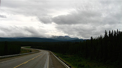
Road from Liard to Teslin
Soon after we left Liard Hot Springs, we saw a large herd of bison grazing along the highway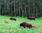 - mostly cows and calves. We had seen "watch for bison" signs, and they weren't kidding! Luckily, the highway is straight and has wide shoulders for better wildlife visibility, and there is not much traffic, so it is easy to avoid collisions. It would be very intimidating to ride through a herd of Bison on a motorcycle, though, not to mention a bicycle!
Today it rained most of the way, but as the sun came out, the scenery got better, and it's quite beautiful here. This stretch of the Alaska Highway plays keep-away between the British Columbia and Yukon border, crossing back and forth several times before finally deciding to move into the Yukon.
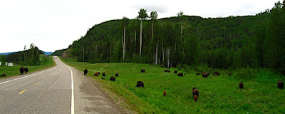
Along the way, we began to see mystery tracks along the side of the road. At least Devin thought they were tracks - I was pretty sure they had been made by something mechanical for the highway, since they were so regular, there was a set on each side of the road, and they went on and on for miles. I just about had him agreeing with me, when we caught up with the makers of the mystery tracks - two HUGE Bison bulls, one on each side of the road,
 walking north. The mystery deepens! The cows and calves were miles back - why were these two solo bulls walking north on the highway, on opposite sides of the road yet together, away from the herd? Were they outcasts? They were both so huge and healthy looking, it is hard to imaging they had lost a dominance challenge - maybe the females just didn't want them around...?
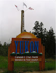
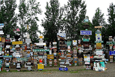
Finally we got to the official border crossing and stopped to take our obligatory photo of the sign - "Welcome to North of 60" and "Yukon, Canada's True North." Shortly after the border we came to Watson Lake and many more signs- tens of thousands more - the famous Watson Lake Signpost Forest! According to the website Explore North,
One of the most famous of the landmarks along the Alaska Highway was started by a homesick GI in 1942... and you can even add your own sign to the over [60,000] already there!In 1942, a simple signpost pointing out the distances to various points along the tote road being built was damaged by a bulldozer. Private Carl K. Lindley, serving with the 341st Engineers, was ordered to repair the sign, and decided to personalize the job by adding a sign pointing to his home town, Danville, Illinois. Several other people added directions to their home towns, and the idea has been snowballing ever since.
What a crazy place. We didn't stop or add our own sign, but did drive around the block and took photos of the tens of thousands of signs taking up a couple of acres of land.
Further up the highway, we checked out Dawson Peaks RV Park as a potential place to camp - it was very nice, in a forest on a lake, and we read in The Milepost that it was featured in the Sue Henry Alaska Mystery,"Dead North" which sounded interesting, but something told us to keep going that day.
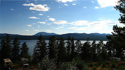
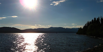
We ended up at the famous Mukluk Annie's, where everything is FREE, FREE, FREE!- Free camping on Teslin Lake
- Free dump and fill
- Free boat ride with dinner
- Free RV wash with dinner
- Salmon Bake (not free, but a great deal by itself!)
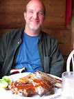 We were hungry and went to dinner - omg. HUGE portions! Quite good, too - salad bar with green salad and fixin's, potato salad, pasta salad, rolls, baked beans and baked potato, then a huge plate of salmon and/or ribs, grilled right there, coffee and/or tea to drink, and even dessert!
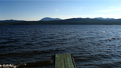
The only problem was I fell asleep after such a huge meal and missed the free boat ride. It was supposed to leave at 8pm, and I got there probably a minute or two after and the boat was already pretty far out, so I think they left early. So sad, standing at the dock alone... I guess I'll try to collect on the way back, if they are still open.
Teslin and Teslin Lake seem to be big Tlingit areas - with museums and stores offering Tlingit goods. We crossed the continental divide again today - up here the water on the west drains to the Bering Sea/Pacific via the Klondike River, and the waters to the east drain into the MacKenzie and into the Arctic Ocean up by Inuvik. The native people on this (west) side of the divide had Pacific salmon runs and a plentiful, regular food supply, so tended to be more settled in villages, where the ones in the Arctic watershed generally did not have a reliable food supply in one place, so followed the Caribou herds and were more nomadic. A very clear example of how environment affects culture.
I talked to some bicyclists in front of the restaurant who were riding the Alaska Highway south, and I was thinking how intimidating it would be to have to ride between those Bison bulls on a bike! The woman was from Quebec and had monster thighs - she's obviously been doing this a while. She is riding to South America! The man was from Germany, and they were just riding together for a while for safety - they had just seen a bear crossing the road earlier today.
Today, in addition to the bison, we also saw Harriers, Golden Eagles, deer, and two black bears - one dead and one alive. The lake here has swallows - barn swallows and rough-winged(?) and terns and gulls. I'm sure there are ospreys and bald eagles, too. We passed through lots of moose country, but didn't see any today. We also passed through a Caribou Herd area, but didn't see them, either. Still, a herd of bison, two huge lone bison bulls, a golden eagle, 3 harriers, a deer and 2 bears is pretty darn good for one day's drive!
3 comments:
That lake looks AWESOME.
Exactly how far from a major popualtion center?
@Mike - Depends on how you define "major"! There is a town ON the lake (Teslin, population about 450). Teslin Lake is "only" three hours north (not that far, relatively speaking) from the larger town of Watson Lake (population about 1500), where the "signpost village" is. And about two hours to the north of the lake is Whitehorse, Yukon's capital and most populous city (about 25,000).
Actually, Watson Lake is home to around 2000 people now, it looks like.
Post a Comment